California’s Hub for Environmental Learning and Action (CHELA) is a new website resource for inquiry- and place-based learning on topics related to environmental literacy and environmental justice. It is designed to leverage the power of geospatial technologies to accelerate environmental learning, connect to students’ lived experiences, and support them in pursuing their interests in confronting and responding to environmental challenges and the implications of climate change. The creation of CHELA was made possible by the leadership and momentum of the California Environmental Literacy Initiative (CAELI). Its design was developed by the California Geographic Alliance (CGA) and enhanced by a team from San Diego Mesa College. The implementation of CHELA has been supported by the National Geographic Society through a one-year grant from its California Geography Education Fund. CHELA takes advantage of cloud-based software for mapping and spatial storytelling that is offered free to all K–12 schools by Esri.
What Does Geography Have to Do with Environmental Literacy?
The time is right for a fresh look at how geographic thinking is a critical building block of environmental literacy and, more generally, a contribution to more equitable approaches to inquiry-based learning. Environmental literacy is about making connections and leveraging systems-level thinking, as highlighted by the Environmental Principles & Concepts. Environmental literacy is also about informing individual actions and activating individuals and groups to make the necessary shifts to share resources more equitably and live more sustainably within the limits of what the planet provides. The state’s commitment to environmental literacy as an outcome for all students, both through the Blueprint for Environmental Literacy and the Environmental and Climate Change Literacy Projects, reframes and re-emphasizes the importance of geographic knowledge and skills for all of our students. Teachers and students alike are energized to explore and take action on a wide range of environmental issues. The goal of environmental literacy will depend on building scientific and social scientific knowledge encompassing natural and human environments across a range of scales. At the same time, it will also depend on accounting for the position, experience, and contributions of each person, family, and local community. People and natural systems connect in the places where we live, study, and work. Encountering and understanding those places more deeply makes all students more visible and is central to all work aiming to develop environmental literacy and a commitment to environmental justice.
Geography is a discipline that holds great power to contribute to environmental literacy, environmental justice, and educational equity. First, geography always maintains a spatial perspective – in other words, a focus on location. Geography’s spatial perspective equips learners with tools to analyze contexts, material conditions, and relationships and to compare and think about the suitability of specific locations for specific activities. Importantly, students can use location to highlight any (i.e., their own) position on Earth and to navigate to meet specific goals. The simple commitment of attention to location and spatial relationships, especially when inclusive of the students’ local knowledge and experiences, is a significant shift toward student-centered learning and equitable representation.

Secondly, geography uses an ecological perspective to provide tools for understanding the interconnections and interdependencies of the complex landscapes that we experience directly and the broader configurations and representations of space, power, culture, and nature that give shape to our known worlds. How is the ground you stand on and the actions you carry out putting you in connection with ecosystems, economies, and other human beings around you? How are your future plans dependent on the sustainability of natural and human systems? The profound implications of shared space and limited resources mean that society and individual actors are in a stronger position by virtue of being able to have a comprehensive understanding of the multivariate environment in which they operate.
It is not only the nature of our questions but also the information density of our modern lives that make geography particularly valuable. Geospatial technologies put incredible amounts of environmental and socioeconomic information within easy reach of anyone with an internet connection and web browser. New and valuable pieces of geographic information are generated via satellite and airplane-mounted sensors that tirelessly observe the Earth, the Census, and the millions of devices now tied into the internet of things, to mention only a few sources. Geographic information systems (GIS) make it possible for us to harness and map all of the information in order to see and know our home, our town, and our planet in ways that are truly incredible. The everyday experience of using an online map service is like having the ability to soar over the land at any altitude and access hidden information about routes (traffic?), destinations (still open, busy?), and other features like waterways and landfills. The real magic comes in using all of that information to make better decisions. Geospatial technology empowers students to explore, analyze, and connect with the land beneath their feet in new ways. Geography enables students to understand and take meaningful action.
What Is CHELA?
California’s Hub for Environmental Learning and Action (CHELA) is a web-based platform (chela.calgeography.org) designed for the use of educators and students. The website includes three primary features for students: an inquiry toolkit, a storytelling showcase, and an interactive environmental atlas. While CHELA is designed to be attractive and informative for students, there is also a page of resources for educators. During the piloting phase of CHELA, educators could find ideas for testing the site, sample atlas inquiries, and a link to a feedback form.
The CHELA Inquiry Toolkit provides a starting place for students to take their own questions and begin to build knowledge, advance their thinking, and develop more focused inquiries. The ladder of environmental literacy and the Global Competence Framework used by the California Global Education Project is referenced as guides for implementing inquiries purposefully and ethically. The toolkit helps students orient themselves to frameworks for engaging with environmental issues, existing topics of concern, and organizations involved in managing or monitoring the environment. There is also direct access to tools students can use to create and contribute their own spatial data, such as iNaturalist for documenting biodiversity and Debris Tracker for documenting trash.

The Storytelling Showcase is an opportunity to emphasize the value of all voices. The showcase enables any member of a school community or a partner in environmental action to share a perspective, experience, or action, generating a map layer that allows subsequent users to discover the messages of those nearby or in an area of interest. This page of the CHELA website also features links to resources for using one’s voice to effect change and examples of how people spoke up and became advocates for sustainability or environmental justice.
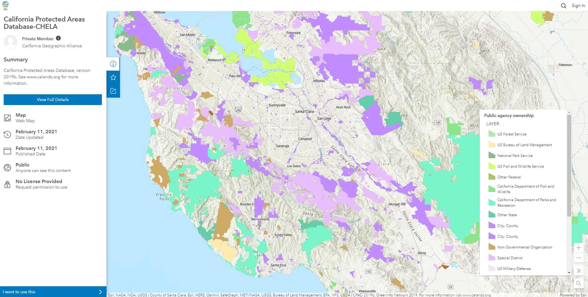
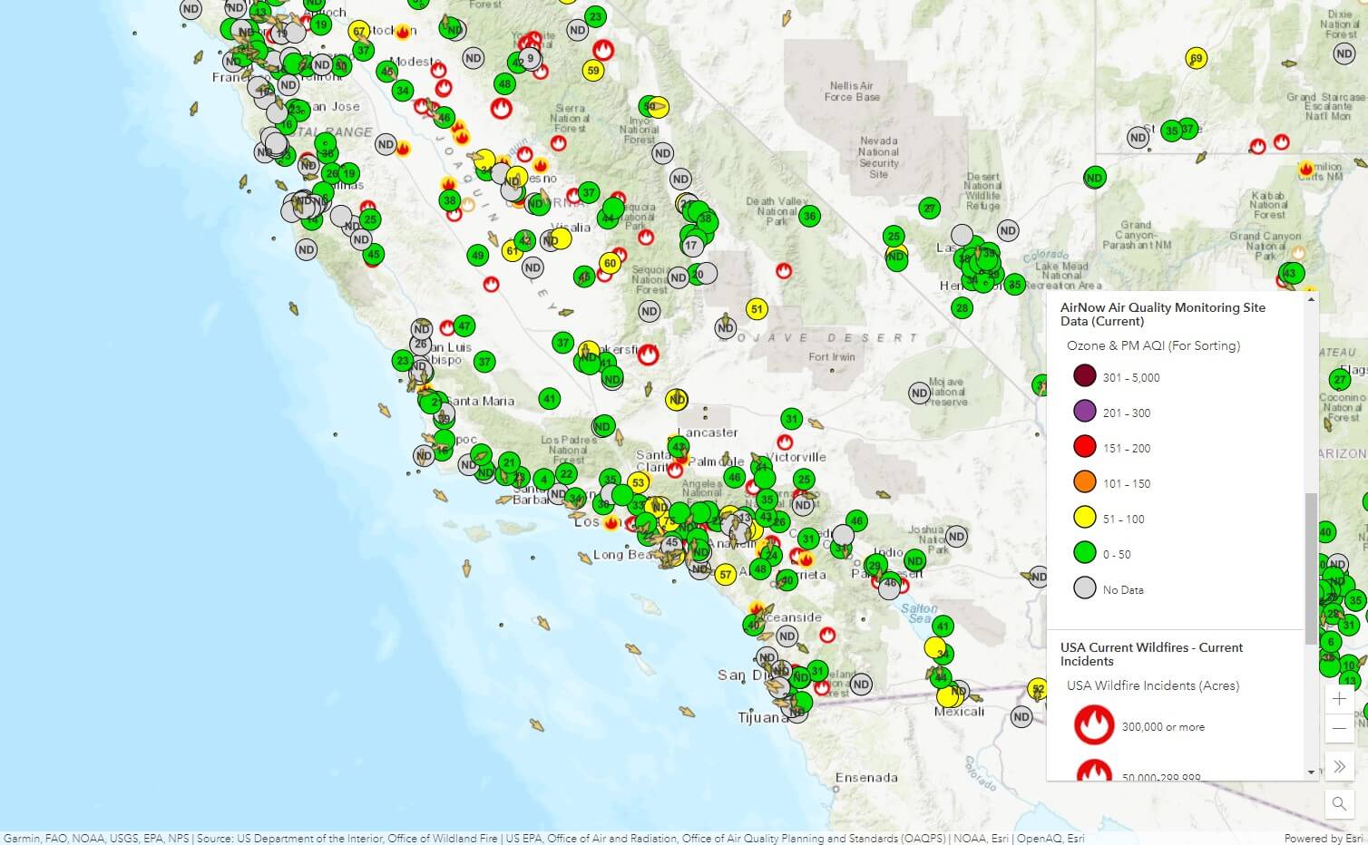
The Interactive Atlas is more than a collection of maps. It is an invitation for students to see the world around them in new ways. In fact, Esri uses the tagline “See what others can’t” when promoting its GIS software. The atlas capitalizes on web-based GIS to give students access to thematic maps and authoritative datasets on a wide, and growing, range of environmental topics. Many maps integrate real-time data, such as from air quality sensors and weather stations, while others include historic data and map layers. Each map allows students to zoom in on their own area of the state and make new discoveries.
The atlas also incorporates a range of perspectives, through media and text-rich StoryMaps created by different authors. While data on environmental conditions is crucial, being able to communicate different perspectives on those conditions is also vitally important. Democratizing access to data and place representations can help us to heed the advice of novelist Chimamanda Ngozi Adichie to avoid “the danger of a single story.” CHELA users are encouraged to extract data for use in their own local work and campaigns. Educators who sign up for a free Esri organizational account can have their students create their own ArcGIS Online maps and StoryMaps to organize information and tell the stories that matter to them. Esri provides excellent online support, and the California Geographic Alliance and other professional development offer training for teachers.
The creation of CHELA was made possible by the leadership and momentum of Ten Strands and the California Environmental Literacy Initiative (CAELI).
Meet the Mappers

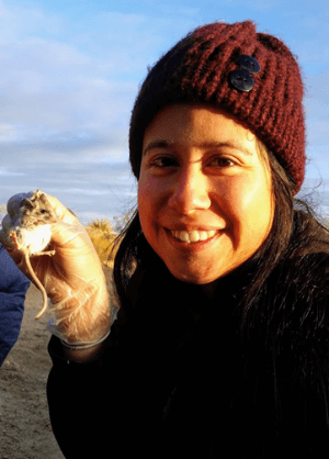
Dr. Thomas Herman has been associated with the Geography Department at San Diego State University since 1993. He helped bring the CGA to the department in 2013 and has been helping teachers integrate GIS into instruction for the past five years. He conceived CHELA as the basis for a proposal to the National Geographic Society, then CGA entered into a wonderful partnership with San Diego Mesa College to implement the idea. Professors Dr. Waverly Ray (Geography) and Dr. Rachel Russell (GIS) recruited and supervised a team of Geography and GIS students who developed content for CHELA as part of an internship. Didra Felix, Gaspar Aparacio, and Sharon Jacob each brought passion, experience, and dedication to the project.

Didra Felix enrolled in the GIS Certificate program at Mesa College after earning a degree in Ecology Behavior and Evolution Biology from the University of California, San Diego. One of her maps focuses on the California condor. “The California condor was on the brink of extinction but is now making a comeback with the help of different organizations and community scientists. I feel this may inspire other students to learn more about threatened or endangered species in their area and what they can do to help.” Didra feels that “the greatest benefit for K–12 students having access to an interactive atlas is that they now have the tools to answer questions using map data – and the critical mindset to inquire about them in the first place.”

Gaspar Aparicio is studying Geography with plans to transfer to San Diego State University and pursue a career in Waste Management. “I decided to study Geography and Waste Management, not only because it is a very interesting field to be in, but also because I want to make a positive impact in the world today and in the future.” Gaspar developed maps on groundwater and toxic releases for the CHELA atlas. “The Toxic Release Inventory layer map will help [students] identify where TRI facilities are operating near them and what kind of chemicals or pollutants may be released or used in that area. This would also help them with finding out if there are any neighborhoods or communities being affected by environmental injustice.”

Sharon Jacob is studying GIS after completing a degree in Environmental Studies at the University of California, Santa Barbara. “I have always wanted to study GIS as it is inherently linked to environmental concepts but was intimidated by its more technical aspects. After graduating, I found that having more technical skills is extremely valuable. I want to become well-rounded in my abilities and I’m extremely interested in mapping and cartography. Working with CHELA is the perfect opportunity to utilize and further my experience.” Sharon is excited about the potential of maps to motivate actions. “By visually understanding concepts and determining focal points for improvement, we can bring a mass movement towards building a more sustainable future with many small-scale community achievements.”

